Mount Magog
Stirling Range National Park
Start - Stirling Range Drive
Trail Type - Hike
Length - 6.4km (Return)
Elevation - 506m
Time - 2-4 Hours
Date Hiked - 1st October 2017
Directions - Mount Magog is located on Stirling Range Drive and is the furthest day hike from the turn-off at Chester Pass Rd. Enjoy the drive along the unsealed Stirling Range Drive until you come to the signs for Mount Magog. The car park is located on a downhill one way slip road.
The Hike - Mount Magog was the final day hike that I had not completed in the Stirling Range thanks to a change in weather on my trip here last year. The plan had been to do this hike on the previous day but I was enjoying the Nancy Peak/Devil's Slide combo so much that I lost track of time and didn't have time to get there and summit it before dark. After a bit of a lazy sleep-in at the Mt Trio Campsite I packed up all my stuff and headed off with mostly sunny skies towards my destination for the morning. The drive along Stirling Range Drive was once again a treat with light clouds misting the summits of Bluff Knoll, Toolbrunup and Mount Magog.
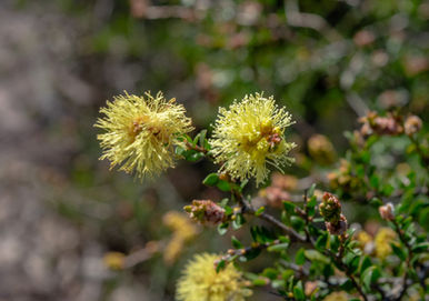
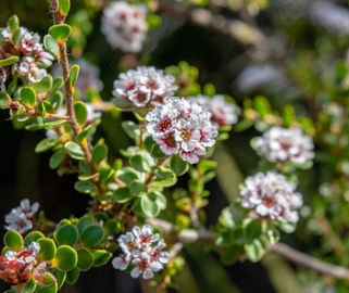
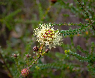
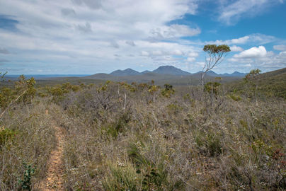
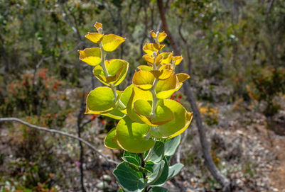
Arriving at the car park I found a couple of gentlemen enjoying something to eat on one of the picnic tables. Given I didn't pass them on the way back I assume they had just finished their hike up to the summit. I went through my usual pre-hike routine of filling water bottles and getting my gear together before setting off to start the journey to the top. With a wet-ish winter and spring there was life in the stream that runs next to the car park and the choir of bird life and frog songs was a nice morning symphony. A small patch of Wandoo forest lines the little valley in the landscape that the stream has forged a path through and there was a good variety of wildflowers dotting the path. It doesn't last long though as you climb out of the valley and start the flat section through scrappy bushland on sandy tracks. Being the longest day hike in the area, pipping Bluff Knoll by a few hundred metres, there is a bit of walk to get to the actual climbing (unlike Bluff Knoll that is all climbing).
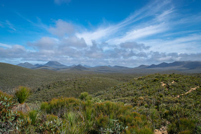
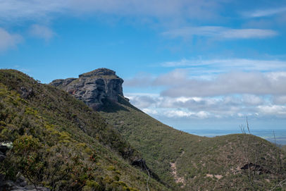
The reason for this is because Mount Magog is set back a bit from Stirling Range Drive and it wouldn't have made sense to ruin the environment by constructing a small road to near where the climbing begins. I actually preferred the flat section as you get a bit of time to warm up and mentally confront your opponent for the next couple of hours. Getting to see the surrounding peaks is unfortunately made a lot easier in parts with some evidence of dieback affecting the area and leaving the vegetation a little sparse. The views are pretty good as you get the interesting peak of Talyuberlup to the right and the rocky protrusion of Mount Magog poking through the trees to the left. When I started there was a light sprinkle of mist around the summit of Mount Magog but with the mid morning sun now getting stronger I knew it wouldn’t last very long.
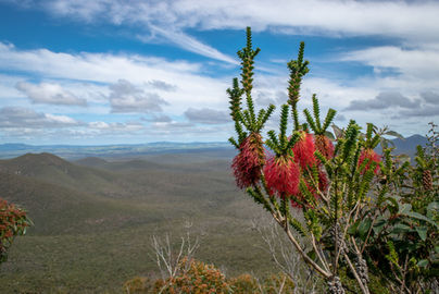
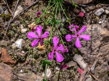
As you approach the climbing, the trail starts to narrow and feel more enclosed as the thickets of bush either side encroach on your personal space a bit more. One advantage of this is of course to shield the sun a little bit and a few wildflowers that appear at eye level made for some cool shots looking back towards Talyuberlup. At this point though the easy stroll ends and the quad burning, hamstring punishing tough stuff begins. This is a very similar hike to Talyuberlup for the majority of the time as the path is steep and rocky in places, surrounded on both sides by a malee type tunnel of bush. I had to double check my calculations a few times when I was looking at the average gradient as it seemed a little steep but according to my GPS tracking, the trail climbs from 450m ASL at the 2.20km mark and tops out at 800m ASL at the 3.1km mark. That's 350m of vertical climbing in 900m, something that really only Talyuberlup and maybe the first 700m of Mt Trio comes close to in terms of gradient for an extended period of time. It certainly felt steep while I was out there with lots of rocks to negotiate and some long leg extensions required, making the winter's worth of Pilates a great decision (thanks to Life of Py regular Tomas for some great Pilates classes).
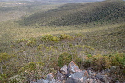
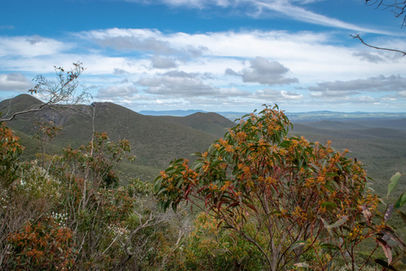
Every now and then I would stop for a breather to take some photos of the stunning scene behind me, which was the typical Stirling Range affair of solitary peaks surrounded by an ocean of long horizons. I could never tire of looking at these types of views so again it was a delight to bear witness to this amazing landscape and reflect on how lucky we are to have areas like this to play in. Amazing Albany does it again. With many photos in the bag I continued the climb and this section of enclosed trail was finished with a literal tunnel of vegetation that you almost have to crawl though leading you to the turnoff point that takes you to the final 200m scramble to the summit. The trail to the summit is fairly obvious with a wooden marker stating that there is a trail this way but it isn't the most well defined path in the area. Be careful not to continue on the path you were on as I think this is a non-marked trail that leads along the ridge to link up with Talyuberlup.
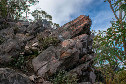
From what I had read about Mount Magog in my research, the final push to the summit was not a marked trail and was pretty much pick your own way to the top. It is fairly obvious where the summit is in relation to everything else but there were a surprising number of wooden markers and tape to guide your way through the also surprisingly mature trees and rock formations. While it is true that the trail is not marked with the official DPaW markers like on Toolbrunup or Bluff Knoll, the wooden crosses (not what you think) and tape do a good job getting you to the summit. There are a few places where you have to think about your next move and some scrambling is required in parts but on the whole it was a relatively pain free ascent to the top. Once there you won't feel the last 900m of ascending screaming out from your legs, only delight at reaching the top and staring out at another fantastic scene. Being the last climbable mountain in the western part of the range you get to look back at all the other peaks and count them off. This is not to say the best views are back to the east with Red Gum Pass still prominent to the west and the location of my previous days hike, the Porongurups, in the distance to the south.
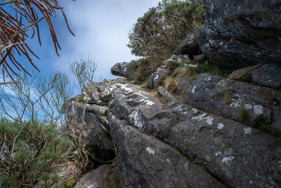
The summit cairn isn't as elaborate as the one on top of Talyuberlup given the lack of open space but you are higher than Talyuberlup so that has to count for something. I had great fun exploring the summit area and taking many photos of the interesting cloud formations. With a few swigs of liquid I headed back down the mountain, not taking the right path once before realising the error of my ways and doubling back to find the maze of crosses and tape. One benefit of this was finding a bit of rock with what looked like a purple tinge to the area surrounding the lichen (see photo sliders). With the sun's intensity now more prevalent in the midday sun I saw quite a few king skinks and was being very cautious not to land on one as I descended down the many rocky steps that dot the trail. I stopped photographing them after a while as almost every step was accompanied by a rustling in the leaves or the sight of one retreating to safety. I arrived back at the car park a very happy camper and got changed for my drive into Albany for lunch (can recommend Kate's Place on Stirling Terrace as a good lunch spot).
Final Thoughts - Mount Magog was always a hike I had left to doing last in the Stirling Range (for no particular reason) and was the victim of circumstance last year that I didn't get to hike it, so it was nice return with nice weather for what was a very nice experience.
My preconceptions were that it was going to be an uninteresting walk out to the climbing section and then a confusing or frustrating experience to get to the summit. How I was wrong though.
As I said in Episode One of the Real Trail Talk podcast (now available on iTunes), it would be nice to get some walks around the base of the peaks in the Stirling Range so you can appreciate the peaks from a much lower perspective and the extended walk out to Mount Magog allows for this.
Like I mentioned before, it is very similar to Talyuberlup in terms of the type of trail but Mount Magog is the tougher hike with a steeper gradient and more vertical climbing to get through.
I can highly recommend this hike for anyone in the area and it certainly tops off my experience with the Stirling Range day hikes with a positive glow. I can now say that there are no bad or even average hikes in the park, maintaining this area as one of the best places in WA to go hiking.
Get out there and experience it!
Be sure to tag any Mount Magog photos on Instagram with #thelifeofpy and if you enjoyed this hike then feel free to share this page on Facebook with your friends.
If you've found this page or the website helpful and you want to show your support then consider making a small donation by visiting our Ko-fi page. You can give as little as a dollar with no sign-up required and everything will be put towards the website, creating new content and promoting the trail community.


