Mount Mangana
South Bruny Island
Directions - Located on South Bruny Island, the Mount Mangana Walk is a short drive from Adventure Bay. From Adventure Bay, head north along Adventure Bay Road, turning left onto Coolangatta Road. Drive on this unsealed road all the way up the hill, that can be steep in places but suitable for a 2WD car, until you see the blue signs for Mount Mangana. Park in the small clearing to the left and the trail starts at the blue post pointing you into the forest.
The Hike - Mount Mangana is the highest point on Bruny Island at 577m ASL and thankfully there is a walk trail that takes you right to the top. After experiencing the wonderful Mavista Nature Walk as my first hike of the day, I was ready to move on from the temperate rainforest course to the mountain course of today's planned hiking banquet. Being the highest point on the island at a not insignificant height, I was expecting the track to be a steep and challenging affair that Tasmania loves to throw at hikers. As I drove up Coolangatta Road, it became apparent that the bulk of the grunt work would be done on these twisty and steep backroads.
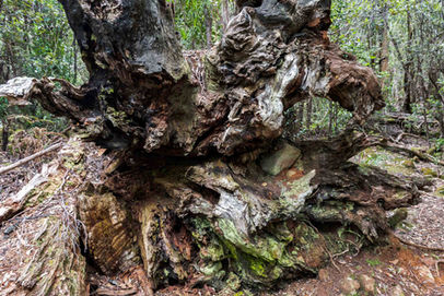
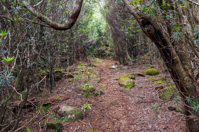
Arriving at the obvious start point, there were two large vehicles already there, so I stuck my hire car in the available space and got my gear ready. The entry into the forest felt more like I was heading into a creepy fairytale where sinister things would be waiting for me, as the undergrowth was really dense and formed a dark canopy. Once I had penetrated that initial layer, it turned into a much friendlier experience with a visible path leading up the hill that was contained a thicket of skinny trees running either side. Aiding with the climb in places are a series of stone steps, some covered in moss (please avoid standing on the mossy parts if you can), and for the most part, the ascent didn't feel that taxing on the body. The main part of the climbing only averages a 13% gradient, pretty gentle in Tassie terms and manageable for most people. With the sun shining bright, the photos were a little compromised but there were times when it disappeared behind a cloud and I could capture the scene much better. One thing I found quite a lot of along the trail was the brilliantly named Dog Vomit Slime Mould (Fuligo septica). I initially thought it was plastic that had fallen out of someone's bag or pocket but on closer inspection, it was definitely organic.
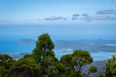
As the vegetation changed into thicker Cheeseberry plants that formed narrow corridors, I was greeted by the owners of the two vehicles at the start. A couple of young couples, they seemed friendly and advised me of where to go at the summit as apparently you get no views from the official summit. Continuing on, the thicker vegetation continued all the way to the summit, where I popped out onto a cleared section of the forest that contained a Trig Point that had fallen over and a modern solar array/antennae. The other group told me to head to the right of the solar panels and follow that track to a rocky outcrop, where there would be the kind of views you'd expect from the tallest point on the island. They weren't wrong and soon I was climbing onto the spotty rocks and staring north over the rest of the island, and across to the mainland. The views are limited but at least you get some reward for the effort of hiking up here. Having a wander around, being careful not to fall off the steep drops, I photographed away at everything I could see that wasn't just limited to the views. A few skinks, some Dragon Heath and a butterfly caught my eye as I clambered around. With two more hikes to do in the day, I headed back to the main path and descended down towards the car, spotting the literal tail end of a snake slivering off.
Final Thoughts – Being the highest point on Bruny Island, Mount Mangana is an obvious place to put a trail and I'm glad they did.
The densely forested interior of South Bruny Island is not something most would associate with visiting this stunning location, so to be able to show it off, plus have the limited views is a bonus.
It might not rival Cradle Mountain or anything in Southwest National Park but for the casual walker, this is a fun hike that is worth doing if you're visiting Bruny Island.
Get out there and experience it!
Be sure to tag any Mount Mangana photos on Instagram with #thelifeofpy and if you enjoyed this hike then feel free to share this page on Facebook with your friends.
If you've found this page or the website helpful and you want to show your support then consider making a small donation by visiting our Ko-fi page. You can give as little as a dollar with no sign-up required and everything will be put towards the website, creating new content and promoting the trail community.


